
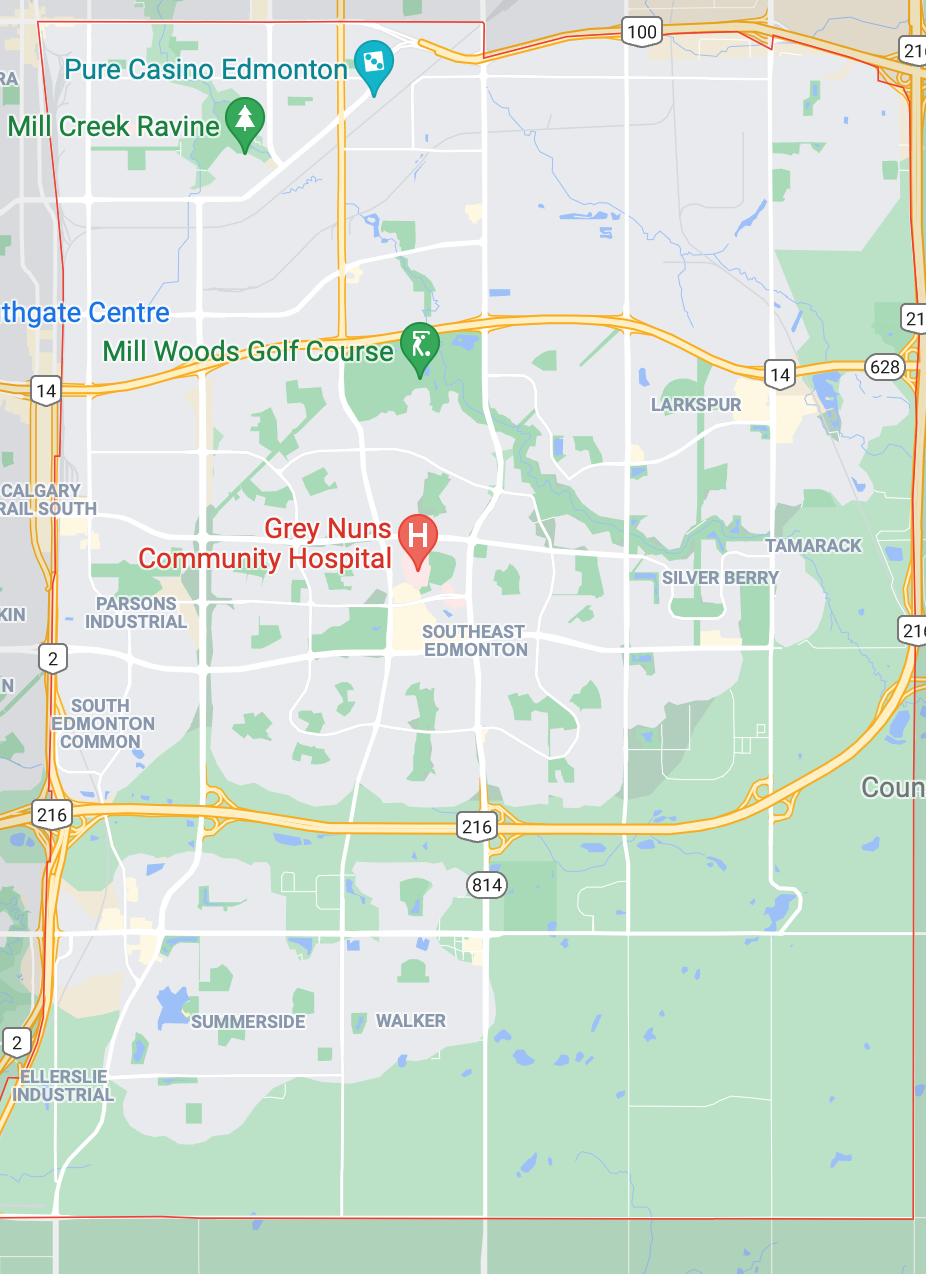
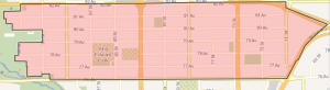
Southeast Edmonton Homes For Sale
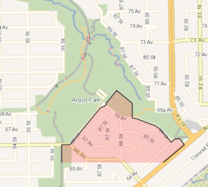 Click Image To View MLS® Listings in Argyll, Edmonton |
Argyll | SIGN UP HERE for Argyll Neighbourhood News including new MLS® listings and sold statistics. | Map it | |
 Click Image To View MLS® Listings in Aster, Edmonton |
Aster | SIGN UP HERE for Aster Neighbourhood News including new MLS® listings and sold statistics. | Map it | |
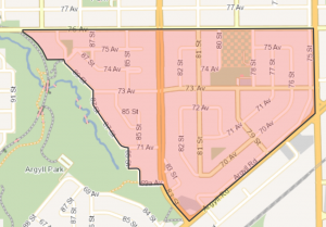 Click Image To View MLS® Listings in Avonmore, Edmonton |
Avonmore | SIGN UP HERE for Avonmore Neighbourhood News including new MLS® listings and sold statistics. | Map it | |
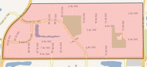
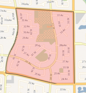 Click Image To View MLS® Listings in Bisset, Edmonton |
Bisset | SIGN UP HERE for Bisset Neighbourhood News including new MLS® listings and sold statistics. | Bisset Bisset is named for Judge Athelstan Bisset, Q.C. Like all of the 27 neighbourhoods of Mill Woods, Bisset’s design objective is to provide for an efficient flow of traffic while minimizing its disruptive and hazardous effects. A number of strategically place pathways promote pedestrian and bicycle travel within the neighbourhood. |
Map it |
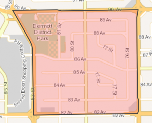
 Click Image To View MLS® Listings in Bonnie Doon, Edmonton |
Bonnie Doon | SIGN UP HERE for Bonnie Doon Neighbourhood News including new MLS® listings and sold statistics. | Bonnie Doon At the turn of the 20th century, the cities of Edmonton and Strathcona were engaged in an intense rivalry to attract growth. This competition and a nation wide land boom led both cities on a path of rapid subdivision and expansion. The portion of Bonnie Doon that lies west of 91 Street was annexed by Strathcona in 1907 and was later absorbed by Edmonton through the amalgamation of the two cities in 1912. In 1913, Edmonton expanded once more and included eastern Bonnie Doon within its borders. At the time, Bonnie Doon seemed somewhat distant from the development concentrated around 82 Avenue and 103 Street, but the extension of a streetcar line made development of the area more attractive. Early residents of Bonnie Doon took advantage of the river valley views by constructing their residences in the northwest corner of the neighbourhood next to the Mill Creek Ravine and overlooking the North Saskatchewan River. During the inter-war years, Edmonton grew rather slowly, and by 1950 less than half of the present structures in Bonnie Doon had been constructed. After World War II and the discovery of oil at Leduc, Edmonton again underwent tremendous growth. Neighbourhoods like Bonnie Doon began to fill out. Bonnie Doon’s development is still underway as structures are added each decade; much of this construction is in fact redevelopment as original structures are replaced by ones with a higher density of a different use. |
Map it |
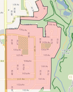
 Click Image To View MLS® Listings in Capilano, Edmonton |
Capilano Homes | SIGN UP HERE for Capilano Neighbourhood News including new MLS® listings and sold statistics. | Capilano Bounded by the green spaces of the river valley and Gold Bar Ravine, Capilano features beautifully landscaped 1950s-era homes, tree-lined streets and two attractive parks named for prominent early Edmontonians. |
Map it |
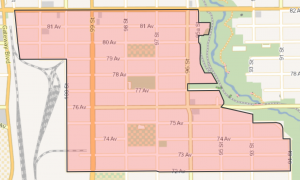
 Click Image To View MLS® Listings in Charlesworth, Edmonton |
Charlesworth | SIGN UP HERE for Charlesworth Neighbourhood News including new MLS® listings and sold statistics. | Map it | |
 Click Image To View MLS® Listings in Cloverdale, Edmonton |
Cloverdale | SIGN UP HERE for Cloverdale Neighbourhood News including new MLS® listings and sold statistics. | Cloverdale Cloverdale is situated along the south bank of the North Saskatchewan River near the centre of the city. Settlement of Cloverdale began in the 1870s when two farms were established. Most of today’s Cloverdale was annexed in 1907 by 1915 the neighbourhood was fully established with a school, stores, local industries and churches. Recreational open space has become the major land use in the neighbourhood, and beautiful Gallagher Park provides the stage for the annual Edmonton Folk Festival. |
Map it |
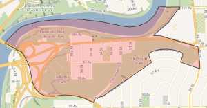
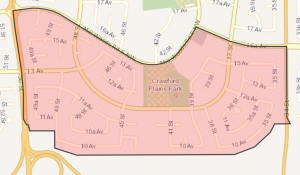 Click Image To View MLS® Listings in Crawford Plains, Edmonton |
Crawford Plains | SIGN UP HERE for Crawford Plains Neighbourhood News including new MLS® listings and sold statistics. | Crawford Plains Crawford Plains is one of the City’s newer communities, dating to the late 1970s. Like many Mill Woods neighbourhoods, it features attractive curving streets and cul-de-sacs. A school and recreational site lies at the heart of the neighbourhood, a particularly appealing feature for the 60 percent of households which have young children (over 90 percent of residents are under 40). Retail, health and other services are available in nearby Mill Woods Town Centre. |
Map it |
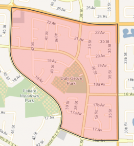 Click Image To View MLS® Listings in Daly Grove, Edmonton |
Daly Grove | SIGN UP HERE for Daily Grove Neighbourhood News including new MLS® listings and sold statistics. | Daly Grove Named in honour of Thomas Daly, who developed high quality strains of wheat and oats, Daly Grove’s predominantly single family homes were built in the 1980s. An efficient road system provides quick access to other City districts while preserving a quiet and safe core community for the young families which make up the majority of households. Daly Grove is well served by Mill Woods Town Centre, as well as its own smaller business centre. |
Map it |
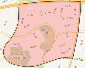 Click Image To View MLS® Listings in Ekota, Edmonton |
Ekota Homes | SIGN UP HERE for Ekota Neighbourhood News including new MLS® listings and sold statistics. | Ekota In the Cree language, Ekota means ‘special place.’ Ekota was, like all Mill Woods residential neighbourhoods, planned in efficient, curved streets and cul de sacs. Ekota contains no commercial properties and few businesses, but a variety of goods and services are available at the nearby Town Centre Mall. Typical of new suburban neighbourhoods, Ekota has a high proportion of young families. |
Map it |
 Click Image To View MLS® Listings in Ellerslie, Edmonton |
Ellerslie Homes | SIGN UP HERE for Ellerslie Neighbourhood News including new MLS® listings and sold statistics. | Ellerslie “Ellerslie” is the name that has existed since the turn of the 20th century. Some believe the name comes from Ellerslie House, the birthplace of William Wallace. Others believe the named was given by the brothers John and James McLaggan, owners of the first store and post office. The Ellerslie School District was established in 1895 and the post office began operating in 1896. The Ellerslie neighbourhood was planned and built-out in the early 2000s. The neighbourhood features several natural tree stands, many small parks, and pathways. |
Map it |
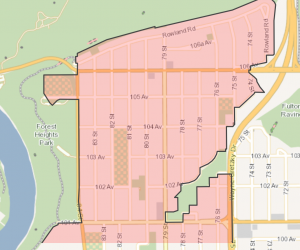 Click Image To View MLS® Listings in Forest Heights, Edmonton |
Forest Heights_Edmonton | SIGN UP HERE for Forest Heights Neighbourhood News including new MLS® listings and sold statistics. | Forest Heights The winding green curves of the North Saskatchewan River Valley figure prominently in Forest Heights. Four bridges provide access to North Edmonton, while area business is concentrated on the roads which bound the vicinity. Built in the 1950s, Forest Heights has grown into a mature and stable community. |
Map it |
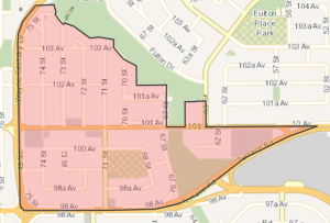
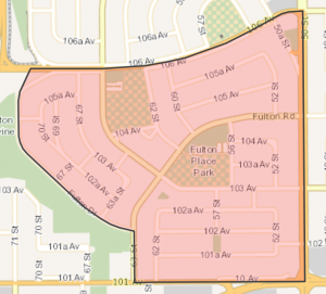 Click Image To View MLS® Listings in Fulton Place, Edmonton |
Fulton Place | SIGN UP HERE for Fulton Place Neighbourhood News including new MLS® listings and sold statistics. | Fulton Place Named for the creek which runs through the ravine on its west boundary, Fulton Place lies east of the downtown core and developed in the 1950s. Today, Fulton is a mature neighbourhood with a stable population. Residents have easy access to the river valley, as well as scenic views from vantage points along Fulton Drive. |
Map it |
 Click Image To View MLS® Listings in Gold Bar, Edmonton |
Gold Bar | SIGN UP HERE for Gold Bar Neighbourhood News including new MLS® listings and sold statistics. | Gold Bar Gold Bar lies to the City’s east, offering easy access to other areas of Edmonton. There are businesses located within Gold Bar, and additional services can be found at nearby Capilano Mall. A mature and stable neighbourhood, with a high proportion of residents over 50 years of age, this area is highlighted by the river valley and ravines, with beautiful views of Goldstick Park and the Gold Bar ravine. |
Map it |
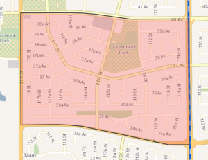 Click Image To View MLS® Listings in Greenfield, Edmonton |
Greenview_Edmonton | SIGN UP HERE for Greenview Neighbourhood News including new MLS® listings and sold statistics. | Greenview One of the 27 Mill Woods neighbourhoods — and highlighted by some of the area’s most attractive homes — Greenview’s development dates mostly to the 1970s and 80s. It lies close to the Mill Woods Golf Course and Mill Woods Town Centre, and features a multiple-purpose school and recreational area. |
Map it |
 Click Image To View MLS® Listings in Hazeldean, Edmonton |
Hazeldean | SIGN UP HERE for Hazeldean Neighbourhood News including new MLS® listings and sold statistics. | Hazeldean Hazeldean is located on an area identified as the land holding of I. Irvine, W. Ogilvie and C. Anderson by the first river lot and township surveys of the Edmonton Settlement. Hazeldean was annexed to the City of Strathcona in 1907. In 1912 Edmonton and Strathcona amalgamated. With Mill Creek Ravine to the east, Hazeldean residents have ready access to the North Saskatchewan River Valley park system. |
Map it |
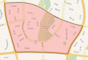 Click Image To View MLS® Listings in Hillview, Edmonton |
Hillview | SIGN UP HERE for Hillview Neighbourhood News including new MLS® listings and sold statistics. | Hillview Hillview is located immediately to the north of the Grey Nuns Community Hospital. The neighbourhood is bounded by major roadways while interior streets follow curved and keyhole patterns. A number of strategically placed walkways through Hillview make for convenient walking or cycling from place to place. The neighbourhood focus of Hillview is its two elementary schools and park sites. |
Map it |
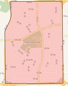 Click Image To View MLS® Listings in Holyrood, Edmonton |
Holyrood | SIGN UP HERE for Holyrood Neighbourhood News including new MLS® listings and sold statistics. | Holyrood Holyrood has many of the design features found in neighbourhoods developed during the 1950s: tree-lined interior streets are arranged in a modified grid pattern and incorporate several landscaped street islands. A small commercial plaza is located in the southeast corner of Holyrood. Bonnie Doon Mall, a regional shopping centre, is just southwest of the neighbourhood. |
Map it |
 Click Image To View MLS® Listings in Idylwylde, Edmonton |
Idylwylde | SIGN UP HERE for Idylwylde Neighbourhood News including new MLS® listings and sold statistics. | Idylwylde Idylwylde is bounded by four major roadways, which serve to keep the area’s centre quiet. Composed primarily of single-family homes, Idylwylde also contains several apartment buildings, a high school and commercial businesses. Residents, the majority of whom are retired or older than 50, enjoy easy access to the many retail services at nearby Bonnie Doon Mall. |
Map it |
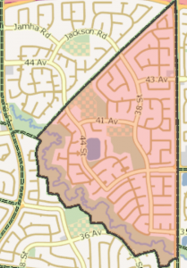
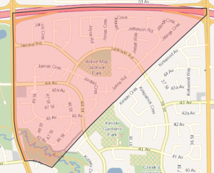 Click Image To View MLS® Listings in Jackson Heights, Edmonton |
Jackson Heights | SIGN UP HERE for Jaackson Heights Neighbourhood News including new MLS® listings and sold statistics. | Jackson Heights Jackson Heights is named in honour of Annie B. Jackson, first policewomen in Canada. Appointed to the Edmonton Police Department in 1912, she received world-wide acclaim when her photograph as a Policewoman appeared on the front page of the London Daily Mirror on August 8, 1913. By 1971, a development plan had been prepared by the City of Edmonton. Jackson Heights is a triangular shaped neighbourhood with part of the Mill Creek Ravine crossing through the southern portion of the neighbourhood. Almost all of the roads are named after someone significant in the history of Edmonton. |
Map it |
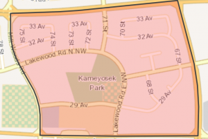 Click Image To View MLS® Listings in Kameyosek, Edmonton |
Kameyosek Homes | SIGN UP HERE for Kameyosek Neighbourhood News including new MLS® listings and sold statistics. | Kameyosek Kameyosek, which means “the beautiful” in Cree, lies near the heart of the Mill Woods area. A mix of single-family and multi-unit dwellings clustered around the central school site, the area is served by a small commercial plaza, the Mill Woods campus of Grant MacEwan College and two high schools. |
Map it |
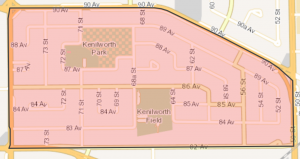 Click Image To View MLS® Listings in Kenilworth, Edmonton |
Kenilworth Homes | SIGN UP HERE for Kenilworth Neighbourhood News including new MLS® listings and sold statistics. | Kenilworth Kenilworth lies in the City’s southeast, immediately north of the vibrant Whyte Avenue. Most homes – a mix of single and multi unit dwellings — were built in the 1960s. Bounded by major traffic routes, residents have easy road access to major shopping and commercial areas. and employment centres. |
Map it |
 Click Image To View MLS® Listings in King Edward Park, Edmonton |
King Edward Park Homes | SIGN UP HERE for King Edward Park Neighbourhood News including new MLS® listings and sold statistics. | King Edward Park King Edward Park was farmed as early as the 1870s and annexed in 1912 but most development didn’t occur until the 1950s. The area is characterised by single-family homes on quiet streets and a stable population. King Edward Park features excellent access to the popular path systems of the river valley and to the vibrant commercial and cultural centre of Whyte Avenue. |
Map it |
 Click Image To View MLS® Listings in Kiniski Gardens, Edmonton |
Kiniski Gardens | SIGN UP HERE for Kiniski Gardens Neighbourhood News including new MLS® listings and sold statistics. | Kiniski Gardens Kiniski Gardens was named in honour of Polish-born Julia Kiniski (1899-1969), a dedicated local politician elected in 1963. She only the third women elected to council. Over the course of her ten unsuccessful bids at public office Kiniski became known as “Big Julie” and her election was said to have reinvigorated the public’s interest in City Council. By 1971, a development plan had been prepared for the triangular shaped Neighbourhood by the City of Edmonton. In the late 1910s the southern portion of Kiniski Gardens formed part of the Edmonton Market Gardens. |
Map it |
 Click Image To View MLS® Listings in Larkspur, Edmonton |
Larkspur Homes | SIGN UP HERE for Larkspur Neighbourhood News including new MLS® listings and sold statistics. | Larkspur Larkspur was named after an ornamental wildflower plant that blooms in many colours. All neighbourhoods in the Meadows area are named after plants and flowers. A pipeline corridor runs the north to south length of the neighbourhood, which has been transformed into a linear park through Larkspur. The Larkspur neighbourhood structure plan (NSP), was originally adopted by City Council in 1987. The neighbourhood began developing in the late 1980s, and was still actively under construction in the 2000s. |
Map it |
 Click Image To View MLS® Listings in Laurel, Edmonton |
Laurel Homes | SIGN UP HERE for Laurel Neighbourhood News including new MLS® listings and sold statistics. | Map it | |
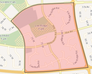 Click Image To View MLS® Listings in Lee Ridge, Edmonton |
Lee Ridge | SIGN UP HERE for Lee Ridge Neighbourhood News including new MLS® listings and sold statistics. | Lee Ridge Lee Ridge, named for Robert Lee (Mayor of Edmonton, 1909 – 1910), is one of the 27 neighbourhoods of Mill Woods. Residential development in Lee Ridge began in 1972 and was complete by the end of the decade. The focus of the neighbourhood is a multiple purpose school and recreational site. Residents of Lee Ridge are served by nearby shopping centres as well as the health services, commercial, recreational and educational facilities of the nearby Mill Woods Town Centre. |
Map it |
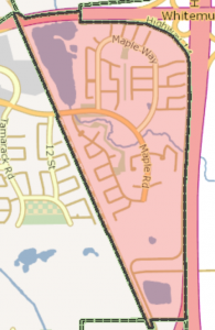 Click Image To View MLS® Listings in Maple, Edmonton |
Maple | SIGN UP HERE for Maple Neighbourhood News including new MLS® listings and sold statistics. | Map it | |
| Meadows Area | SIGN UP HERE for Meadows Area Neighbourhood News including new MLS® listings and sold statistics. | Map it | ||
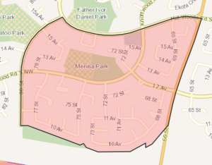 Click Image To View MLS® Listings in Menisa, Edmonton |
Menisa | SIGN UP HERE for Menisa Neighbourhood News including new MLS® listings and sold statistics. | Menisa In the Cree language, Menisa means “berries” which were abundant in the Parkland vegetation that grew in the Mill Woods area. Residential development in Menisa began in 1976 and was nearly complete by 1980. Residents of Menisa are served by businesses in the Menisa Shopping Centre as well as the health services, commercial, recreational and educational facilities in Mill Woods Town Centre. |
Map it |
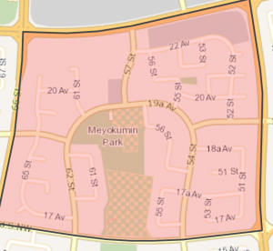 Click Image To View MLS® Listings in Meyokumin, Edmonton |
Meyokumin | SIGN UP HERE for Meyokumin Neighbourhood News including new MLS® listings and sold statistics. | Meyokumin Meyokumin, which means “good water” in Cree, was part of the Papaschase Indian Reserve created in 1876. The Reserve was later sold to early white settlers and much of the land in the Mill Woods area was in agricultural production until the late 1960s. |
Map it |
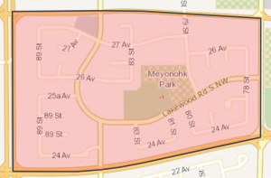 Click Image To View MLS® Listings in Meyonohk, Edmonton |
Meyonohk | SIGN UP HERE for Meyonohk Neighbourhood News including new MLS® listings and sold statistics. | Meyonohk Meyonohk, meaning “an ideal spot” in Cree, reflects the neighbourhood’s good access to the recreational facilities of nearby Mill Woods Park and to major areas of employment in the industrial areas to the west and north. Residents of Meyonohk are served by local businesses as well as the health services, commercial, recreational and educational facilities of Mill Woods Town Centre. |
Map it |
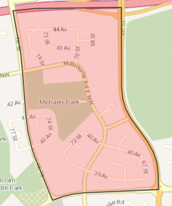 Click Image To View MLS® Listings in Michaels Park, Edmonton |
Michaels Park | SIGN UP HERE for Michaels Park Neighbourhood News including new MLS® listings and sold statistics. | Michaels Park Michaels Park was named in honour of John Michaels who was involved in community service for 50 years and was best known for his promotion of aviation and the north country. At the centre of Michaels Park is a multi-purpose open space and recreational site. The residents of Michaels Park are served by the local businesses as well as health services, commercial, recreational and educational facilities of the nearby Mill Woods Town Centre. |
Map it |
 Click Image To View MLS® Listings in Mill Woods Town Centre, Edmonton |
Mill Woods Town Centre | SIGN UP HERE for Mill Woods Town Centre Neighbourhood News including new MLS® listings and sold statistics. | Map it | |
 Click Image To View MLS® Listings in Minchau, Edmonton |
Minchau | SIGN UP HERE for Minchau Neighbourhood News including new MLS® listings and sold statistics. | Minchau Minchau was named in honour of August Minchau, who immigrated from Poland in 1894 and settled in the Mill Woods area. The focus of Minchau is a large multiple purpose school and recreational site adjoining Mill Creek Ravine. The ravine provides an opportunity to residents to explore wildlife habitats and areas of natural vegetation. High-density housing and commercial sites are located near the recreational area along collector roadways. |
Map it |
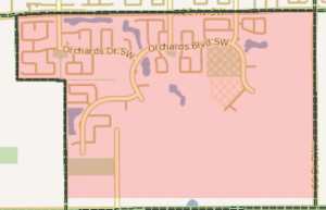 Click Image To View MLS® Listings in Orchards at Ellerslie, Edmonton |
Orchards At Ellerslie | SIGN UP HERE for Orchards at Ellerslie Neighbourhood News including new MLS® listings and sold statistics. | Map it | |
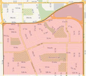 Click Image To View MLS® Listings in Ottewell, Edmonton |
Ottewell | SIGN UP HERE for Ottewell Neighbourhood News including new MLS® listings and sold statistics. | Ottewell Ottewell is one of the City’s largest neighbourhoods, defined by major roadways on all four sides. The residential population is stable, with a higher than average number of residents older than 40. The area is named for the Ottewell family, who were among the first settlers south of the river in the 1880s and whose home is now on display in Fort Edmonton Park. |
Map it |
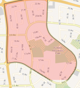 Click Image To View MLS® Listings in Pollard Meadows, Edmonton |
Pollard Meadows | SIGN UP HERE for Pollard Meadows Neighbourhood News including new MLS® listings and sold statistics. | Pollard Meadows Pollard Meadows is one of the 27 neighbourhoods of Mill Woods. While much of the area was built in the 1970s and 80s, over a fifth remains undeveloped. A high proportion of residents have children at home. Pollard Meadows families are served by two elementary schools. Excellent commercial amenities are available at nearby Mill Woods Town Centre Mall. |
Map it |
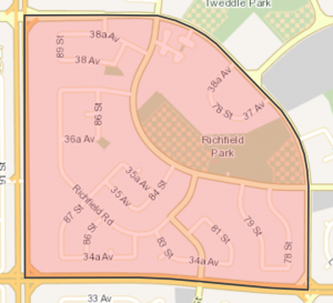 Click Image To View MLS® Listings in Richfield, Edmonton |
Richfield | SIGN UP HERE for Richfield Neighbourhood News including new MLS® listings and sold statistics. | Richfield Part of Mill Woods, Richfield was developed in the 1970s in a system of pleasantly curving streets and cul-de-sacs. A multiple purpose school and recreational area lie at its heart, as does the Millbourne Community shopping facility. The health, commercial, recreational and educational facilities of Mill Woods Town Centre are close by. |
Map it |
 Click Image To View MLS® Listings in Ritchie, Edmonton |
Ritchie | SIGN UP HERE for Ritchie Neighbourhood News including new MLS® listings and sold statistics. | Ritchie Ritchie is a residential neighbourhood in south east Edmonton, developed during the immediate post-war period. It is named for the original owner of the Ritchie Mill and former mayor of the City of Strathcona. The population of Ritchie enjoys good access to the nightlife of nearby Old Strathcona and the Mill Creek Ravine. Whyte Avenue provides good access to the University of Alberta. 99 Street, which passes through the neighbourhood, provides good access to the downtown core. |
Map it |
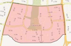 Click Image To View MLS® Listings in Sakaw, Edmonton |
Sakaw | SIGN UP HERE for Sakaw Neighbourhood News including new MLS® listings and sold statistics. | Sakaw One of the 27 Mill Woods neighbourhoods, Sakaw means “wooded area” in Cree. Most residences in this quiet area are for single families, and construction of row housing and apartment buildings is ongoing. Good roadways link the area to the City’s commercial centres. Local needs are met by Millhurst Shopping Centre and Mill Woods Town Centre. |
Map it |
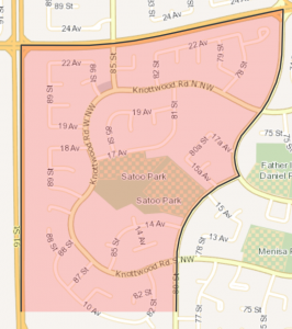 Click Image To View MLS® Listings in Satoo, Edmonton |
Satoo | SIGN UP HERE for Satoo Neighbourhood News including new MLS® listings and sold statistics. | Satoo Named for a Cree chief, the Mill Woods area was a Cree reserve between 1876-1891. Satoo is a quiet, attractive neighbourhood popular with young families. Nearly 80 percent of residences are single-family homes, and more than two thirds of households include children. Residents enjoy access to a local shopping centre and proximity to Mill Woods Town Centre. |
Map it |
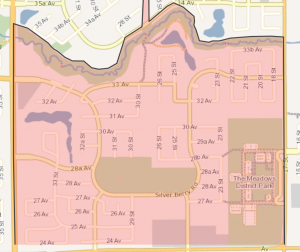 Click Image To View MLS® Listings in Silver Berry, Edmonton |
Silver Berry | SIGN UP HERE for Silver Berry Neighbourhood News including new MLS® listings and sold statistics. | Map it | |
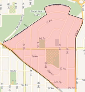 Click Image To View MLS® Listings in Strathearn, Edmonton |
Strathearn | SIGN UP HERE for Strathearn Neighbourhood News including new MLS® listings and sold statistics. | Strathearn Two of the original landholders were J. McKernan, Edmonton’s first telegraph operator, and W. Bird who built one of Edmonton’s first water driven grain mills in Mill Creek. Donnell Road in Strathearn was named after another of the early landowners. A small part of the Strathearn area was annexed to the City of Strathcona and subdivided in 1907. Most of Strathearn remained undeveloped until the late 1940s and 1950s. |
Map it |
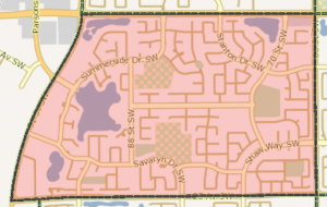 Click Image To View MLS® Listings in Summerside, Edmonton |
Summerside | SIGN UP HERE for Summerside Neighbourhood News including new MLS® listings and sold statistics. | Map it | |
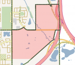
 Click Image To View MLS® Listings in Tamarack, Edmonton |
Tamarack | SIGN UP HERE for Tamarack Neighbourhood News including new MLS® listings and sold statistics. | Map it | |
 Click Image To View MLS® Listings in Tawa, Edmonton |
Tawa | SIGN UP HERE for Tawa Neighbourhood News including new MLS® listings and sold statistics. | Tawa Tawa means “you are welcome” in the Cree language to honour Aboriginal leaders and history. The Tawa neighbourhood represents the northern half of the Mill Woods Town Centre. Tawa¿s primary land use is institutional, and the Grey Nun¿s Hospital and a large school/park site fill out the centre of the neighbourhood. Residential construction in Tawa began in the 1990s and continued into the early 2000s. |
Map it |
 Click Image To View MLS® Listings in Terrace Heights, Edmonton |
Terrace Heights_Edmonton | SIGN UP HERE for Terrace Heights Neighbourhood News including new MLS® listings and sold statistics. | Terrace Heights Terrace Heights is located on land identified by the first river lot and township surveys of the Edmonton Settlement as part of River Lots 31 and 33 and a quarter section of land held by D. McLeod. McLeod was a Hudson Bay Company employee, turned sawmill operator, who, in 1883, pioneered regular weekly stagecoach travel between Edmonton and Calgary. In effect, the Terrace Heights neighbourhood is two quiet single-unit residential areas separated by a high density residential and commercial corridor along 101 Avenue. |
Map it |
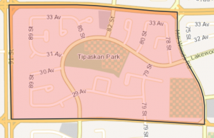 Click Image To View MLS® Listings in Tipaskan, Edmonton |
Tipaskan | SIGN UP HERE for Tipaskan Neighbourhood News including new MLS® listings and sold statistics. | Tipaskan Tipaskan, a word meaning “a reserve” in the Cree language, recalls that the Mill Woods area was a Cree Indian reserve between 1876 and 1891. Developed in the 1970s and 1980s, 41% of homes are single unit structures, 39% are row housing and 19% are low-rise apartments. |
Map it |
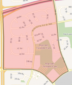 Click Image To View MLS® Listings in Tweddle Place, Edmonton |
Tweddle Place | SIGN UP HERE for Tweddle Place Neighbourhood News including new MLS® listings and sold statistics. | Tweddle Place Tweedle Place was named in honour of Malcolm Tweddle, a former City Commissioner. The focus of the neighbourhood is a multiple purpose school and recreational site. The mix of housing in Tweddle Place reflects a “compact development” philosophy of early development in Mill Woods |
Map it |
 Click Image To View MLS® Listings in Walker, Edmonton |
Walker | SIGN UP HERE for Walker Neighbourhood News including new MLS® listings and sold statistics. | Map it | |
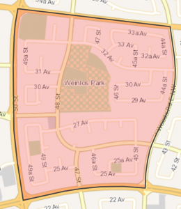 Click Image To View MLS® Listings in Weinlos, Edmonton |
Weinlos | SIGN UP HERE for Weinlos Neighbourhood News including new MLS® listings and sold statistics. | Weinlos Weinlos was named after Dr. Morris Weinlos (1902-1980) and Dr. Harry Weinlos (d. 1977) who were prominent surgeons and active members of local arts and humanitarian initiatives within Edmonton. Weinlos began to experience development in the 1970s but the bulk of development occurred through the 1980s. The internal streets of Weinlos are arranged in a curvilinear pattern. The neighbourhood does not contain any commercial land uses, but residents have good access to the Town Centre Mall situated directly west of Weinlos. |
Map it |
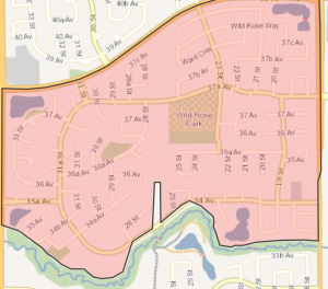 Click Image To View MLS® Listings in Wild Rose, Edmonton |
Wild Rose | SIGN UP HERE for Wild Rose Neighbourhood News including new MLS® listings and sold statistics. | Wild Rose Wild Rose is named for Alberta’s official flower, Rosa acicularis (wild rose), which has been this province’s official flower since the 1930s. Mill Creek runs the length of the neighbourhood’s southern border and provides a significant natural asset for Wild Rose residents. Wild Rose features public access to Mill Creek and also incorporates a variety of other parks and open space corridors to provide excellent access to outdoor amenity space for residents. |
Map it |

